
Formation of the Greater Ranges of Asia
The Himalayas and Karakoram are two of the highest mountain ranges in the world. The Himalayas stretches across 2900 km, passing through six countries, and contains the highest mountain on Earth (Mt Everest if you're wondering) yet it is one of the youngest ranges. On the other hand, Karakoram is only 500 km across but it has the densest concentration of high peaks (over 8000 m) and it is one of the most glaciated parts outside of the polar regions. The Himalayan mountains continue to grow because the region is still very tectonically active, resulting in a high frequency of earthquakes. The formation of the mountains has caused global impact from changing oceanic circulation patterns to inducing the South Asian Monsoons, just in case the heights of the mountain ranges weren't impressive enough!The two mountain ranges share the same drive of formation: the collision between India and Eurasia. If we wind back to the early Mesozoic, during the time of Pangaea, India was neighbouring Africa, Antarctica and Australia in the southern hemisphere while Eurasia was located in the north. The two landmasses were separated by the Tethys Ocean. This arrangement was disrupted approximately 175 Ma years ago when Pangaea started to break apart and the Indian plate began to move towards Eurasia. This plate movement was due to convergent plate boundaries. The key plate boundary was located along the southern margin of the continental Eurasia plate where the oceanic plate, which is denser than continental plate, was being subducted into the mantle. The subduction zones started to close the Tethys ocean and India moved at a rate of 10-20 mm per year until around 50 Ma, when the two continental plates collided.

The plates continued to converge but the rate India travelled northwards was reduced to 5 mm per year. As the Indian plate and Eurasian plate are both light density continental rocks, the continents began to uplift creating some of the world's greatest mountain ranges. The collision caused the rocks to buckle and fold over, creating the stunning geology. This process continues today as the crust of the Indian plate carries on thrusting under that of the Eurasian plate causing the crustal thickness of the region to be twice the average. Ladakh, located in the state of Kashmir and Jammu in India, is dominated by the geology that created the two mighty mountain ranges. The five main geotectonic units from south to north are: Tethys Himalaya, Indus-Tsangpo Suture Zone, Ladakh arc, Shyok Suture Zone and the Karakoram block. During our road trip from Manali to Leh and around, we were able to have a glimpse of the beautiful landscape the region had to offer.

Starting our journey in the Himalayas
Our road trip officially started in Manali. Technically we took an overnight coach leaving Delhi at 7 pm and arriving in the town of Manali at around 9 pm so you could say our road trip started further south but as I spent most of this journey either yearning for that Blue and Gold Sari I didn't have time to buy or trying to find a comfortable position to sleep in, the excitement did not start until the day after. By then I had already missed half of the Himalayan tectonic units: The clastic sediments (sourced from the Himalayas as they eroded) of the Sub-Himalayan unit and metamorphosed sedimentary rocks (sourced from the Indian platform) of the Lower Himalayas unit. Unfortunately the trip only improved a little as we had to pass the apparently majestic Rohtang Pass in complete cloud cover (damn that Monsoon season).
The start of the road trip took place within the High Himalayan Crystalline Sequence: The Climax of the Himalayan orogeny. The rocks here were originally Precambrian to Mesozoic sedimentary rocks that were metamorphosed into medium to high grade metamorphic rocks during the peak of the Himalayan formation in the mid-Tertiary (though the rocks have undergone many phases of deformation). Here, mica schists, quartzites and gneiss that represent up to amphibolite facies can be found. The HHCS was intruded by leucogranites in the Miocene which also formed migmatites in the process. In fact, Manali is located on one of these High Himalayan Leucogranites. Our four hour drive was spent completely in the HHCS as we spent the night in Keylong. The view of homes on mountain tops was one of the best views among the many others.

The sky cleared the next day just in time for us to enjoy the Tibetan Tethys Zone in its full glory. The TTZ is the most northerly zone of the Indian plate and the numerous formations within it show how much the environment has changed! This zone represents a sedimentary shelf facies that formed in the passive northern margin of the Indian plate, which has been divided in two by Carbiferous-Permian volcanic rocks. The earlier Precambrian to Carboniferous Lahoul Supergroup moves from shallow water sedimentary rocks to terrestrial formations (continental molasse, aeolian sandstones) back to marine formations (limestones, evaporites, deltatic clastics). The Panjal Traps are the continental flood basalts from the Carboniferous to Permian period that occurred from the break up of Gondwana. Post volcanism, the Zanskar Supergroup represents a return to marine setting with carbonate platforms, carbonate sediments, shales, sandstones and limestones that eventually evolved into shallow water setting. The TTZ is largely unmetamorphosed and contains abundant fossils indicating the rich biodiversity that once existed in the Tethyan Sea.

The most dominant and youngest group in the ITSZ are the Cenozoic Indus Basin sedimentary rocks, also known as the Indus Molasse. These rocks are carbonate or clastic sediments that originated from the Eurasian plate and were deposited south of the Kohistan-Ladakh Batholith. The earlier group of IBSR, the Tar group, shows an evolution into a shallow marine (shales, fine sandstones, limestones) and delta dominated with fluvial deposits (coarse sandstones, conglomerates). The later group, the Indus Group, shows a switch from a marine to a terrestrial setting. The arrival of Indian sediments into the sequence has been used to date the collision of the two continental masses. During the final leg of the Manali-Leh roadtrip, the highway curves through the vibrant maroon and green shales and sandstones and this was the highlight of the trip. It was the first time that I made my driver stop so I could run over to examine the outcrops while James awkwardly tried to explain that I am a geologist through the language barrier (it didn't work).


Once we crossed the Indus River on the highway route, the sedimentary units stopped abruptly and we were greeted by valleys and mountains made of crystalline felsic igneous rocks. This is the Ladakh Batholith, part of the Trans-Himalayan batholith, which stretches 600 km between the Indus Suture Zone in the south and Shyok Suture Zone in the north. The batholith is mostly made of biotite and hornblende granodiorite and granite but there is presence of mafic components in the form of ol-norite and gabbro. Leh sits comfortably within one of these granitic valleys that was shaped by glaciers.

The Ladakh Batholith resulted from the Andean-type magmatism that occurred during the subduction of the Tethys Ocean under Eurasia. The label "Andean type" refers to a subduction of an oceanic plate under a continental plate. As the oceanic lithosphere subducts into the mantle, it partially melts and dehydrates allowing some of the volatiles, especially the water, to percolate to the mantle of the overlying plate. This lowers the melting temperature of the mantle wedge and can cause some melting leading to magmatism, which in this context manifested as mainly plutonism with some volcanism. The Ladakh Batholith is a result of multiple pulses of intrusion of calc-alkaline material that has been uplifted and eroded to its current form today.

The batholith has been dated several times as another way of understanding and timing the formation of the mountain ranges and the beautiful geology surrounding it. Weinberg and Dunlap (2000) used U-Pb and K-Ar dating techniques on zircons and samples of subvolcanic dike respectively. They found that magmatic activity occurred in Leh between 70-50 Ma and the last magmatic event occurred around 49.8 Ma, just around the time when the sedimentary rock suggests collision with India. This suggests that magmatism stopped soon after the collision due to the change in plate boundary (from oceanic-continental to continental-continental) "disrupting" the magmatic system.

The zone between the Ladakh Batholith in the south and the Karakoram units (Eurasian plate) in the north is messy, less studied and not well understood compared to the other geological units. However, there's one thing for sure, it's another collision zone! James and I couldn't wait to drive off to another part of Ladakh and we chose to see the Nubra Valley before Pangong Tso (saving the sunshine for the best part of the trip). Our car drove over the Khardung-La pass and headed to the Nubra Valley within the Shyok suture zone in the northwest.

The Shyok Suture Zone represents the collision between the Ladakh-Kohistan Arc and the Karakoram Block. This second convergent boundary was located south of the Eurasian subduction zone as an intra-oceanic island arc. The geology of SSZ is composed of ophiolitic melanges (sections of the oceanic crust that have been obducted onto continental crust), metamorphosed volcanic rocks and sedimentary rocks. The Shyok Suture Zone represents a "complete section through an oceanic island arc". There is a disagreement between the direction of subduction, the features of an island arc the units represent and the timing of (the Shyok ocean) closure. Moreover, there is still an on going debate today whether the Ladakh-Kohistan island arc collided with the Asian or Indian plate first though it was generally understood that the Ladakh-Kohistan Island Arc collided the the Karakoram Block in the Cretaceous period before the Indian collided with Eurasia in the Tertiary period.

Rolland et al (2000) suggested that the SSZ in Ladakh shows signs of a NW-SE evolution from a back arc to arc formation i.e. the back arc basin was opening in the northwest of the Ladakh Arc and closing eastward. The suggestion comes from the presence of basaltic blocks and tuffs with a geochemistry between mid-ocean ridge basalts and island arc basalts in the northwest and arc setting volcanic rocks in the southwest. The sedimentary and volcanic rocks also suggest a change in the geodynamic setting from west to east: limestones with pillow basalts and lava flows found in the west suggest a effusive eruption in a marine setting while pelites, sandstones and conglomerates with ignimbrite layers suggest a continental setting with a "catastrophic" aerial eruption in the east.

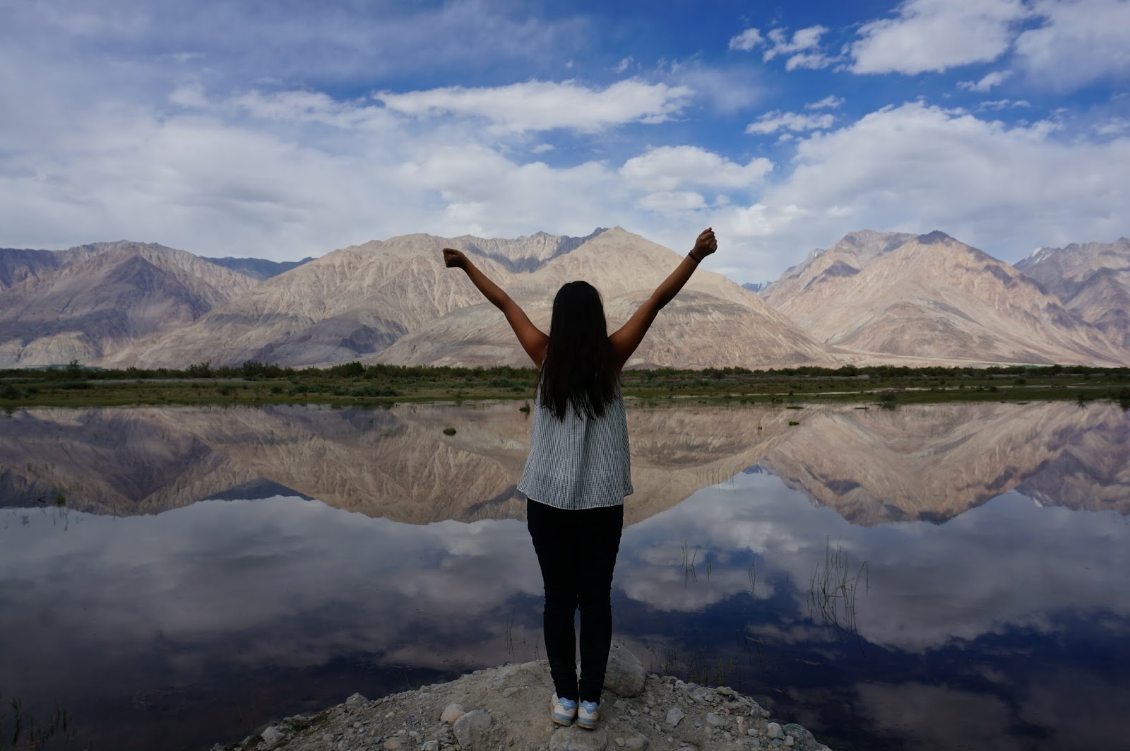
The first time I wanted to visit Pangong Tso was, unsurprising to any desi readers out there, after I watched "3 Idiots". It wasn't the first time I've seen the beautiful lake in a bollywood movie (Dil Se and Jab Tak Hai Jaan were also shot there to name a few) but the scenery in "3 Idiots" was particularly stunning. My dad leaned over to me in the cinema and told me that the lake was in Ladakh and that he'll take us there one day. So I got a little impatient and went there before he had the chance (I hope I'll take them there one day).

Pangong Tso is located in the Karakoram Block, the final geotectonic unit of our Ladakh trip! The Karakoram terrane extends from Hindu Kush, Afghanistan in the west to Tibet in the east. The terrane can be divided into three major lithologies. The most northerly unit is the Karakoram Tethys Zone which is, as you can guess, a sedimentary sequence that records the travel of the Karakoram as it left Gondwana to make the Asian plate: from deep water sediments in the Carboniferous to shallow marine carbonates in the mid-Jurassic. The sedimentary sequence was then intruded by diorites from a pre-collision event. The south of the KTZ is the Karakoram Batholith and this comprises of granites that range from monzogranite to garnet-two mica-leucogranite composition formed by both pre and post collisional events. Karakoram Metamorphic complex lies between the Karakoram Batholith and SSZ. It's made of metasedimentary rocks, amphibolites and gneiss-migmatites which have have been intruded by granitic bodies too!

The Pangong Metamorphic Complex can be found south of the lake and we had a peek of it on our way back from Pangong Tso to Leh. This complex comprises of, as described by Rolland et al (2000, 2002 and 2009), "a granulite facies core and an amphibolitic cortex". The granulite core is mainly made of garnet-bearing gneiss, metabasite and limestone while the amphibolite facies contains metapelitic schists and gneiss along with the presence of metabasic rocks. This complex is bounded by the Karakoram fault and earlier papers suggest that this block has been exhumed from a 18 km depth and moved southwards. The garnets in garnet-kyanite-starulite gneiss show multiple stages of growth implying that the complex underwent many stages of deformation. Thanh (2001) suggested that the garnet cores formed during the subduction setting induced prograde metamorphism, which were then "abruptly" uplifted during the Karakoram-Ladakh Arc collision, and the overgrowth were formed during the continental collision between India and Eurasia.

Looking Back
I had a wonderful time in Ladakh. Before I jumped on a coach to Manali, I knew that Ladakh would be a geologist's paradise. It wasn't until we were in the Himachal Pradesh - Jammu and Kashmir border (when the clouds and mist shifted a little and the temperatures became a little warmer) that I fell in love with my subject again. This was the first time I tried to explore the geology and apply my course to the real world on my own. I gained a new found love for geological field work. I found myself naturally pouring into the literature to put together the pieces I saw. I understood more about the Himalayas now then during my second year course! My only regret is not reading the papers before I left, it would have been great to drive over to the ophiolites or having a closer inspection of the Pangong Metamorphic Complex. Alas, maybe next time!

Driving through the Indus Tsangpo Suture Zone
The Indus Tsangpo Suture Zone (ITSZ) separates the Indian plate from the Eurasian plate. The three units within the the ITSZ show a progression from a deep marine setting to shallow waters progressing into a delta and then finally a continental collision facies. The two earlier main units in the ITSZ are the Lamayuru Complex and the Nimdam-Dras Volcanic Group. The shales, sandstones and limestones of the Lamayuru, which were deposited during the Triassic to Jurassic period, represent the "deep water" marine setting. The Dras Volcanic group (of the Nimdam-Dras unit) comprises of basalt, andesites and dacites that show island arc tholeiitic and primitive calc alkaline geochemistry. The Nimdam group contains volcanoclastic materials, limestone blocks and volcanic blocks. The Dras Group represents an island arc while the Nimdam group suggests a forearc basin which received and deposited sediments from the island arc.
The most dominant and youngest group in the ITSZ are the Cenozoic Indus Basin sedimentary rocks, also known as the Indus Molasse. These rocks are carbonate or clastic sediments that originated from the Eurasian plate and were deposited south of the Kohistan-Ladakh Batholith. The earlier group of IBSR, the Tar group, shows an evolution into a shallow marine (shales, fine sandstones, limestones) and delta dominated with fluvial deposits (coarse sandstones, conglomerates). The later group, the Indus Group, shows a switch from a marine to a terrestrial setting. The arrival of Indian sediments into the sequence has been used to date the collision of the two continental masses. During the final leg of the Manali-Leh roadtrip, the highway curves through the vibrant maroon and green shales and sandstones and this was the highlight of the trip. It was the first time that I made my driver stop so I could run over to examine the outcrops while James awkwardly tried to explain that I am a geologist through the language barrier (it didn't work).

Settling in the Ladakh Batholith


The Ladakh Batholith resulted from the Andean-type magmatism that occurred during the subduction of the Tethys Ocean under Eurasia. The label "Andean type" refers to a subduction of an oceanic plate under a continental plate. As the oceanic lithosphere subducts into the mantle, it partially melts and dehydrates allowing some of the volatiles, especially the water, to percolate to the mantle of the overlying plate. This lowers the melting temperature of the mantle wedge and can cause some melting leading to magmatism, which in this context manifested as mainly plutonism with some volcanism. The Ladakh Batholith is a result of multiple pulses of intrusion of calc-alkaline material that has been uplifted and eroded to its current form today.

The batholith has been dated several times as another way of understanding and timing the formation of the mountain ranges and the beautiful geology surrounding it. Weinberg and Dunlap (2000) used U-Pb and K-Ar dating techniques on zircons and samples of subvolcanic dike respectively. They found that magmatic activity occurred in Leh between 70-50 Ma and the last magmatic event occurred around 49.8 Ma, just around the time when the sedimentary rock suggests collision with India. This suggests that magmatism stopped soon after the collision due to the change in plate boundary (from oceanic-continental to continental-continental) "disrupting" the magmatic system.

Exploring the Nubra Valley in the Shyok Suture Zone

The zone between the Ladakh Batholith in the south and the Karakoram units (Eurasian plate) in the north is messy, less studied and not well understood compared to the other geological units. However, there's one thing for sure, it's another collision zone! James and I couldn't wait to drive off to another part of Ladakh and we chose to see the Nubra Valley before Pangong Tso (saving the sunshine for the best part of the trip). Our car drove over the Khardung-La pass and headed to the Nubra Valley within the Shyok suture zone in the northwest.


Dipping into Pangong Tso & looking onto the Karakoram Block

The first time I wanted to visit Pangong Tso was, unsurprising to any desi readers out there, after I watched "3 Idiots". It wasn't the first time I've seen the beautiful lake in a bollywood movie (Dil Se and Jab Tak Hai Jaan were also shot there to name a few) but the scenery in "3 Idiots" was particularly stunning. My dad leaned over to me in the cinema and told me that the lake was in Ladakh and that he'll take us there one day. So I got a little impatient and went there before he had the chance (I hope I'll take them there one day).

Pangong Tso is located in the Karakoram Block, the final geotectonic unit of our Ladakh trip! The Karakoram terrane extends from Hindu Kush, Afghanistan in the west to Tibet in the east. The terrane can be divided into three major lithologies. The most northerly unit is the Karakoram Tethys Zone which is, as you can guess, a sedimentary sequence that records the travel of the Karakoram as it left Gondwana to make the Asian plate: from deep water sediments in the Carboniferous to shallow marine carbonates in the mid-Jurassic. The sedimentary sequence was then intruded by diorites from a pre-collision event. The south of the KTZ is the Karakoram Batholith and this comprises of granites that range from monzogranite to garnet-two mica-leucogranite composition formed by both pre and post collisional events. Karakoram Metamorphic complex lies between the Karakoram Batholith and SSZ. It's made of metasedimentary rocks, amphibolites and gneiss-migmatites which have have been intruded by granitic bodies too!

The Pangong Metamorphic Complex can be found south of the lake and we had a peek of it on our way back from Pangong Tso to Leh. This complex comprises of, as described by Rolland et al (2000, 2002 and 2009), "a granulite facies core and an amphibolitic cortex". The granulite core is mainly made of garnet-bearing gneiss, metabasite and limestone while the amphibolite facies contains metapelitic schists and gneiss along with the presence of metabasic rocks. This complex is bounded by the Karakoram fault and earlier papers suggest that this block has been exhumed from a 18 km depth and moved southwards. The garnets in garnet-kyanite-starulite gneiss show multiple stages of growth implying that the complex underwent many stages of deformation. Thanh (2001) suggested that the garnet cores formed during the subduction setting induced prograde metamorphism, which were then "abruptly" uplifted during the Karakoram-Ladakh Arc collision, and the overgrowth were formed during the continental collision between India and Eurasia.

Looking Back


I had a wonderful time in Ladakh. Before I jumped on a coach to Manali, I knew that Ladakh would be a geologist's paradise. It wasn't until we were in the Himachal Pradesh - Jammu and Kashmir border (when the clouds and mist shifted a little and the temperatures became a little warmer) that I fell in love with my subject again. This was the first time I tried to explore the geology and apply my course to the real world on my own. I gained a new found love for geological field work. I found myself naturally pouring into the literature to put together the pieces I saw. I understood more about the Himalayas now then during my second year course! My only regret is not reading the papers before I left, it would have been great to drive over to the ophiolites or having a closer inspection of the Pangong Metamorphic Complex. Alas, maybe next time!

References
- Searle, Mike P. Geology and tectonics of the Karakoram Mountains. John Wiley & Sons Inc, 1991.
- Garzanti, Eduardo, Aymon Baud, and Georges Mascle. "Sedimentary record of the northward flight of India and its collision with Eurasia (Ladakh Himalaya, India)." Geodinamica Acta 1.4-5 (1987): 297-312.
- Henderson, Alexandra L., et al. "Geology of the Cenozoic Indus Basin sedimentary rocks: Paleoenvironmental interpretation of sedimentation from the western Himalaya during the early phases of India‐Eurasia collision."Tectonics 29.6 (2010).
- Henderson, Alexandra L., et al. "Constraints to the timing of India–Eurasia collision; a re-evaluation of evidence from the Indus Basin sedimentary rocks of the Indus–Tsangpo Suture Zone, Ladakh, India." Earth-Science Reviews 106.3 (2011): 265-292.
- Phillips, Richard J., Randall R. Parrish, and Michael P. Searle. "Age constraints on ductile deformation and long-term slip rates along the Karakoram fault zone, Ladakh." Earth and Planetary Science Letters 226.3 (2004): 305-319.
- Phillips, Richard J. "Geological map of the Karakoram fault zone, eastern Karakoram, Ladakh, NW Himalaya." Journal of Maps 4.1 (2008): 21-37.
- Rolland, Y., A. Pecher, and C. Picard. "Middle Cretaceous back-arc formation and arc evolution along the Asian margin: the Shyok Suture Zone in northern Ladakh (NW Himalaya)." Tectonophysics 325.1 (2000): 145-173.
- Rolland, Yan, et al. "Syn-kinematic emplacement of the Pangong metamorphic and magmatic complex along the Karakorum Fault (N Ladakh)."Journal of Asian Earth Sciences 34.1 (2009): 10-25.
- Schärer, Urs, Copeland Peter, Harrison T. Mark, and Searle Mike P. "Age, Cooling History, and Origin of Post-Collisional Leucogranites in the Karakoram Batholith; A Multi-System Isotope Study." The Journal of Geology 98.2 (1990): 233-51. Web.
- Searle, M. P. "Structural evolution and sequence of thrusting in the High Himalayan, Tibetan—Tethys and Indus suture zones of Zanskar and Ladakh, Western Himalaya." Journal of Structural Geology 8.8 (1986): 923-936.Sinha, Anshu K., et al. "Contribution to the geology of the eastern Karakoram, India." SPECIAL PAPERS-GEOLOGICAL SOCIETY OF AMERICA (1999): 33-46.
- Streule, M. J., et al. "Evolution and chronology of the Pangong Metamorphic Complex adjacent to the Karakoram Fault, Ladakh: constraints from thermobarometry, metamorphic modelling and U–Pb geochronology." Journal of the Geological Society 166.5 (2009): 919-932.
- Thanh, N. X., et al. "Multiple garnet growth in garnet–kyanite–staurolite gneiss, Pangong metamorphic complex, Ladakh Himalaya: new constraints on tectonic setting." Lithos 127.3 (2011): 552-563.
- Thanh, Ngo Xuan, et al. "A Cretaceous forearc ophiolite in the Shyok suture zone, Ladakh, NW India: Implications for the tectonic evolution of the Northwest Himalaya." Lithos 155 (2012): 81-93.
- Weinberg, R. F., and M. P. Searle. "The Pangong Injection Complex, Indian Karakoram: a case of pervasive granite flowthrough hot viscous crust."Journal of the Geological Society 155.5 (1998): 883-891.Weinberg, Roberto F., and William James Dunlap. "Growth and deformation of the Ladakh Batholith, northwest Himalayas: implications for timing of continental collision and origin of calc‐alkaline batholiths." The Journal of Geology 108.3 (2000): 303-320.


